Mappa Mundi
- Share via
Our word “map” came into English (probably through French) from the Latin phrase mappa mundi, map of the world. But mappa really means table-napkin; a map is the world inscribed on a napkin. It is an imaginative leap, and maps themselves stimulate the imagination. As a youngster (and I am sure I am not alone in this), I knew by heart the coastlines and inland features of that map of Treasure Island that Jim Hawkins’ mother extracted from the baggage of the pirate Billy Bones as he lay dead, struck down by a thundering apoplexy, and I sketched many treasure island maps of my own invention, crowding them with exotic detail. Medieval map-makers, when they reached the limits of the known world, filled the blank space with monsters and wonders: “the Anthropophagi, and men whose heads / Do grow beneath their shoulders,” the mythical Christian kingdom of Prester John in the heart of Asia. They also drew angels with trumpets in the corners of the maps, those angels that John Donne, in a century that no longer believed the world was flat, nostalgically summoned: “At the round earth’s imagin’d corners blow / Your trumpets, Angels. . . .” In another poem he takes a survey of his mistress’ physical charms in cartographic images as he moves first down from her hair to the center and then up from her feet. After her hair, her nose, that “like to the first Meridian runs / Not ‘twixt an East and West, but ‘twixt two suns; / It leaves a Cheek, a rosie Hemisphere / on either side. . . .” He moves down past “the glorious Promontory, her Chin” to “the streight Hellespont between / The Sestos and Abydos of her breasts” and later his imaginary ship “Sailing towards her India, in that way / Shall at her fair Atlantick Navell stay. . . .”
Modern map-makers have dispensed with angels and monsters; they are practitioners of a scientific discipline which has at its disposal such sophisticated resources as aerial photography, satellite data and digital cartography. And these resources have been marshaled to produce the “Barrington Atlas of the Greek and Roman World,” a project initiated by the American Philological Assn. in the 1980s and funded by the Barrington Foundation, the National Endowment and many other generous supporters. The atlas “combines state-of-the-art technology with the most recent scholarship incorporating the results of important new discoveries and excavations never before presented in this form” and covers “the history of settlement of Greek and Roman civilization from the disappearance of the Minoan and Mycenaean civilizations in Greece (about 1000 BC) to the period when Rome’s eastern empire was near collapse, about AD 640.”
An atlas of the ancient world has to be, to some extent, a work of imaginative restoration, for the landscape has undergone vast changes over the millenniums. Ancient cities have disappeared under water (much of ancient Alexandria) or volcanic deposits (Pompeii, Herculaneum) while others are lost under their huge successors; coastlines have changed and rivers have taken, or been made to take, new courses; railroads and highways have covered the land’s surface, artificial lakes and reservoirs have been created. To produce a map of the world’s surface in its original condition, much has to be eliminated, much restored. The need for such an atlas has been recognized for some time and there have been several attempts to provide it, but none has been brought to completion or anywhere near it. The most important, the “Tabula Imperii Romani,” an international project to map the Roman Empire launched in 1920, is ongoing but has made only fitful progress. But now the “Barrington Atlas,” the work of a team of more than 70 international historians and archeologists, led by the coordinator and general editor Richard J.A. Talbert of the University of North Carolina (Chapel Hill) and 12 years in the making, is ready at last.
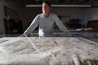
Published by Princeton University Press, this handsome book is of impressive size: 13 inches by 18 1/2 inches. It contains 99 color maps that span the territory of more than 75 modern countries. It has hand-sewn binding, which means that when you consult one of the 75 double-page maps, it lies flat at its center. The maps vary in scale; most of them are 1:1,000,000 or 1:500,000 but there are panoramic maps at 1:5,000,000 (including a three-page fold out that shows the world from the Atlantic to the Middle East) and detailed maps at 1:150,000 (Attica, for example, and Rome and vicinity). Some of them may surprise the reader. What, for example, is a double-page map of India doing here? Alexander, of course, did reach the northeast corner of that vast territory, but why should the atlas show the whole of the subcontinent, including Sri Lanka? And why do some maps cover Ireland, most of Scandinavia and the coast of the Baltic Sea as far east as the Vistula and beyond? The answer is that though there is no evidence for Greco-Roman settlement in these areas, ancient geographers discussed these regions in some detail and have passed on a great deal of information probably derived from travelers, traders and captives.
Together with the atlas comes a CD-ROM that contains detailed references to the scholarly work on which the atlas is based. It also features an introduction to each map, which draws attention “to large or general characteristics of the map which call for special explanation . . . for example, formative figures of the physical landscape and problems encountered in seeking to restore it to its ancient aspect; the nature and development of modern understanding of the cultural landscape, including apparent variations in density arising from uneven exploration; criteria of significance adopted for determining which sites and features (roads / routes in particular) should be marked on the map, and which omitted.” There follows a list, in alphabetical order, of the sites identified on the map with a grid reference to the map; in three columns to the right are specified its period of occupation, its current modern name and references to the scholarly work that deals with it. This section of the CD is followed by lists, with grid references, to such features on each map as aqueducts, bridges, canals, coastal change, dikes, levees, lighthouses, mines, monasteries, passes, roads, villas and walls. For those who prefer to have the CD’s information in print, it is available, for an extra charge, in two bound volumes containing a total of 1,383 large pages.
The maps themselves are a delight to use. Clear print and coloration make them easy on the eye, and a full-page map key explains the symbols: the color tints for elevation, the shapes and colors for physical features (drainage, reef, bog, rapids, cliff, lava, sand, swamp, oasis, etc.); symbols for cultural features (major roads, aqueducts, canals, salt pans, tunnels, urban areas, breakwaters, etc.); the point symbols, dark if the location is certain, light if not, that identify such sites as mines and quarries (there are 25 abbreviations for the metal or stone extracted), whirlpools, springs, wells, lighthouses, cemeteries and spas. With careful study of the maps, one can form a picture of the ancient landscape.
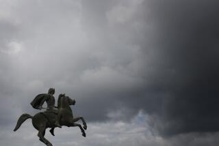
This atlas is an indispensable tool for historians concerned with ancient times. But it is also a source of great pleasure for the amateur, the lover of literature. Maps, as always, stimulate the imagination. In these luminous pages, you can follow Alexander’s zigzag march from Macedon to India, fighting battles and founding Alexandrias--more than a dozen of them--on the way. Across the Hellespont to the site of Troy, where he visits the tomb of Achilles, south to the Greek cities of Ephesus, Miletus and Halicarnassus, east along the south coast and then north into central Turkey to Gordium, where he cut the Gordian knot, onto Tarsus, where much later, St. Paul will be born, and then, after a great victory at Issos, down the Syria-Palestine coast to capture the cities of Tyre and Sidon. On past Gaza to Egypt, to found the first Alexandria and visit the oracle of a Libyan god at Siwah in the desert. Then north again through Syria to win another decisive battle at Gaugemala and south to the great cities of the Persian empire, Susa and Persepolis. Then north again to the shores of the Caspian Sea, followed by a swing south and then north again to the borders of Afghanistan, where he founded another Alexandria, and then finally to India, where, after a victory over the local king, he proposed to push farther east to the ocean, which in his mental map of the world encircled the whole central land mass of the Earth. But his Macedonian troops, who had now marched more than 11,000 miles in seven years of hard campaigning, wanted to go no farther, and he turned back to make his way through some of the most inhospitable desert in the world to Babylon, where he died in 323 BC. He was 32 years old.
You can also follow Horace on his trip from Rome to Brundisium (Brindisi) in 38 BC (“Satires I.v”). You go by horse and carriage to Forum Appii, where he boarded a public barge for a nighttime trip on the canal through the Pontine Marshes. The barge was pulled by a mule on the towpath; the gnats and frogs in the fens made sleep impossible, not to mention the drunken mule driver singing about the girl he’s left behind him. Out of the marshes, he reached Anxur (Tarracina) on the coast, where he was joined by Maecenas, Octavian’s confidant, who was on his way to Brundisium, where he would take a ship for Greece to meet Mark Antony’s envoys in Athens. South they went along the Via Appia to Fundi and then to Sinuessa on the coast, where Virgil joined the party. Here they turned eastward inland to Capua, where Maecenas went off to play ball after dinner, but the two poets went to bed. And so on through the Apulian hill country, where Horace was born and grew up, to the Adriatic coast at Barium and so down to Brundisium.
Or you can imagine yourself one of a contingent of legionnaires on the way from Syria to the wall that still runs on some bare hilltops from Newcastle to Carlyle. You arrive by ship at Portus Dubris with its white cliffs, take the road to Londinium on the River Tamesis and then make the long march to Eburacum (York), where the Emperor Constantine was born and so to your station on Hadrian’s Wall.
Turn to the detailed map of Attica and you can find Colonus, where, Sophocles once wrote, “the nightingale sings on / her dying music rising clear. . . . “ The map is the only place where you will find it, for it lies now beneath the pavement somewhere near the Larissa Station in downtown Athens.
More to Read
The biggest entertainment stories
Get our big stories about Hollywood, film, television, music, arts, culture and more right in your inbox as soon as they publish.
You may occasionally receive promotional content from the Los Angeles Times.


